


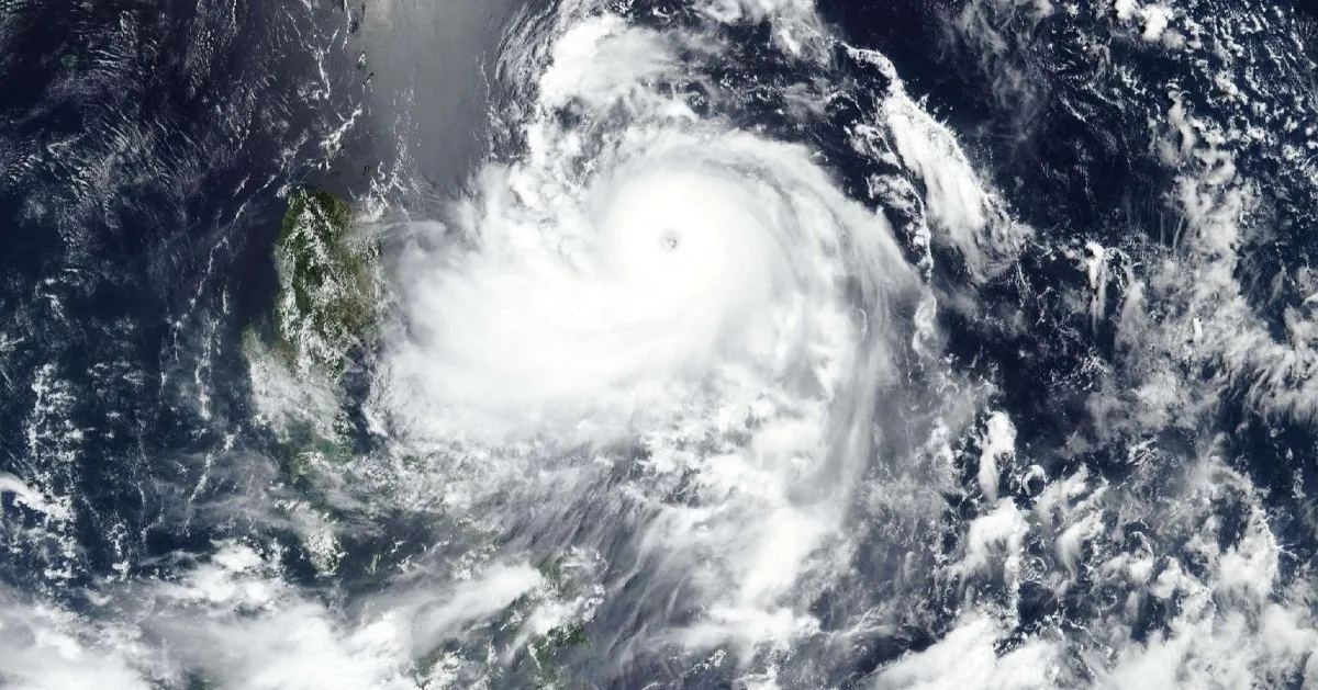
Typhoon Francisco, carrying the international name Mekkhala, rapidly intensified while moving west-northwest over the Philippine Sea on Monday morning, June 22, and the state weather bureau maintained Signal No. 1 over Batanes and parts of Cagayan. Satellite imageries indicated that the center of the eye of Francisco was estimated at 620km east of Tuguegarao City, Cagayan as of 10 a.m.
 Copy link


Narito ang mga winning combination para sa 4D Lotto, Mega Lotto 6/45 at Grand Lotto 6/55 para sa araw ng Miyerkoles, Disyembre 17, 2025, base sa 9 p.m. draw ng Philippine Charity Sweepstakes Office (PCSO).
In its 11 a.m. bulletin, the Philippine Atmospheric, Geophysical and Astronomical Services Administration stated that the typhoon was moving west-northwest at 15kph. The agency emphasized that local government units are responsible for ensuring that their constituents can cope up with the severe weather. Strong to typhoon-force winds extend up to 420km from its center. Signal No. 1 remains hoisted over Batanes, the northeastern portion of Cagayan, specifically Gonzaga and Santa Ana, and the eastern portion of the Babuyan Islands, including Babuyan, Didicas and Camiguin islands.
Warnings were issued by the bureau that areas under Signal No. 1 may experience strong winds of 39kph to 61kph within 36 hours. It was further announced that maritime operations would be suspended tomorrow if the adverse weather conditions result to severe coastal flooding. Furthermore, local winds may be slightly stronger in coastal and mountainous areas, whereas winds would be weaker in areas that are sheltered from the prevailing wind direction, unless sudden topographical shifts occur.
The southwest monsoon, locally known as habagat, and the periphery of Francisco will bring strong to gale-force gusts over several areas. On Monday, these gusts may affect La Union, Pangasinan, Calabarzon, Marinduque, Romblon, Masbate, most of the Visayas, Zamboanga Peninsula, Misamis Occidental, Lanao del Norte, Camiguin, Surigao del Norte, Dinagat Islands, Davao Occidental and Davao Oriental. From Tuesday to Wednesday, strong gusts would be felt across most of Luzon, the Visayas, Northern Mindanao and surrounding territories, e.g., Surigao del Norte and Dinagat Islands.
Coastal warnings were released indicating that rough seas are expected over parts of the northern and eastern seaboards in the next 24 hours. Waves may reach up to 3.5m along the eastern seaboards of the Babuyan Islands and mainland Cagayan, and up to 3m along the eastern seaboards of Batanes, Isabela and northern Aurora.
Moderate seas of up to 2.5m may also affect the remaining seaboards of Batanes, the Babuyan Islands, mainland Cagayan and Aurora; the northern and eastern seaboards of the Polillo Islands and Catanduanes; the northern seaboards of Camarines Norte and Camarines Sur; and the eastern seaboard of Davao Oriental. Smaller waves of up to 2m may affect northern Quezon, Ilocos Norte, Northern Samar, Albay, Sorsogon, Eastern Samar, Dinagat Islands, Surigao del Sur and the Davao regions.
Mariners of small seacrafts and motorbancas were strongly advised by the department not to venture out to sea under these dangerous conditions, especially if they are operating ill-equipped vessels. Appropriate precautions must be taken by coastal populations, and safety protocols would be strictly enforced by local authorities.