


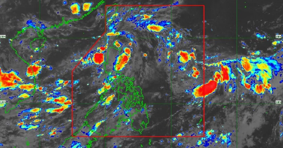
Tropical Storm Domeng has entered the Philippine Area of Responsibility early Friday morning, May 29, but it is currently projected that landfall in the country is unlikely. In its 5 a.m. advisory, the Philippine Atmospheric, Geophysical and Astronomical Services Administration (PAGASA) stated that the tropical cyclone was located one thousand three hundred forty-five kilometers east of Southeastern Luzon.
 Copy link


Narito ang mga winning combination para sa 4D Lotto, Mega Lotto 6/45 at Grand Lotto 6/55 para sa araw ng Miyerkoles, Disyembre 17, 2025, base sa 9 p.m. draw ng Philippine Charity Sweepstakes Office (PCSO).
It was observed by the state weather bureau that the storm is packing maximum sustained winds of 75kph near the center and gustiness of up to 90kph. The tropical cyclone was moving northwestward at 20kph. As of Friday morning, no tropical cyclone wind signals were raised over any part of the country by the agency.
Unless the storm alters its current trajectory, it is expected that the southwesterly windflow would be enhanced, which may result to heavy rains over the western portions of the country beginning Sunday to Monday. In anticipation of possible heavy rainfall, a weather advisory would be issued on Saturday to ensure that vulnerable communities can cope up with the incoming deluge. It was emphasized that local disaster risk reduction and management councils must prepare their rescue equipments early.
Furthermore, strong to gale-force gusts may affect most parts of the Visayas and several areas in Luzon and Mindanao, e.g., coastal and upland communities exposed to winds. Among the areas that would experience strong winds beginning Saturday are Batanes, Cagayan, Pangasinan, Zambales, Bataan, Cavite, Batangas, Occidental Mindoro, Oriental Mindoro, Romblon, Marinduque, Masbate, Albay, Sorsogon and Palawan. In Mindanao, affected areas include Zamboanga del Norte, Misamis Oriental, Camiguin, Agusan del Norte, Surigao del Norte, Dinagat Islands, Sarangani, Davao Occidental and Davao Oriental.
A strict warning was issued by the bureau to mariners of motorbancas and similarly sized vessels to exercise caution while venturing out to sea. Rough coastal conditions are expected along the eastern seaboards of Batanes, Cagayan, Isabela and Dinagat Islands, as well as the eastern and southern seaboards of Davao Oriental, where wave heights may reach up to 2m.
Domeng is forecast to continue moving northwestward until Sunday before turning north northwestward to northward for the remainder of the forecast period. It was added by the department that the storm would intensify into a typhoon by Saturday while over the Philippine Sea before gradually weakening afterward.
With an unusually active start to the 2026 typhoon season, this comprehensive guide provides essential strategies for emergency kit preparation, home reinforcement, and clear action timelines to help your family stay safe and resilient when storms strike.